
Comet 67P/Churyumov–Gerasimenko
Processing of OSIRIS spectroscopic cam images from ESA’s Rosetta spacecraft
About OSIRIS (Optical, Spectroscopic, and Infrared Remote Imaging System)
OSIRIS is the scientific imaging system on the orbiter of ESA’s Rosetta mission to comet 67P/Churyumov-Gerasimenko.
OSIRIS comprises two cameras: a high resolution Narrow Angle Camera (NAC) and a Wide Angle Camera (WAC). OSIRIS observes the cometary rotation, and studies the physical and chemical processes that occur in, on, and near the cometary nucleus.
The strength of OSIRIS is the coverage of the entire nucleus and its local environment with high spatial and temporal resolution. The spectral sensitivity entends the reflected solar continuum from the near-UV up to the onset of thermal emission.
Read more: https://www.mps.mpg.de/en/rosetta/osiris
© Max-Planck-Institut für Sonnensystemforschung
Learn more on the Mission Rosetta website: https://www.esa.int/Science_Exploration/Space_Science/Rosetta
I acknowledge the Principal Investigator H. Sierks (MPS, Goettingen, Germany) of the OSIRIS instrument onboard the Rosetta mission for providing datasets in the archive | Datasets of the OSIRIS instrument have been downloaded from the ESA Planetary Science Archive (https://psa.esa.int).
Credit: ESA / Rosetta / MPS for OSIRIS Team MPS / Jackie Branc CC BY-SA 4.0
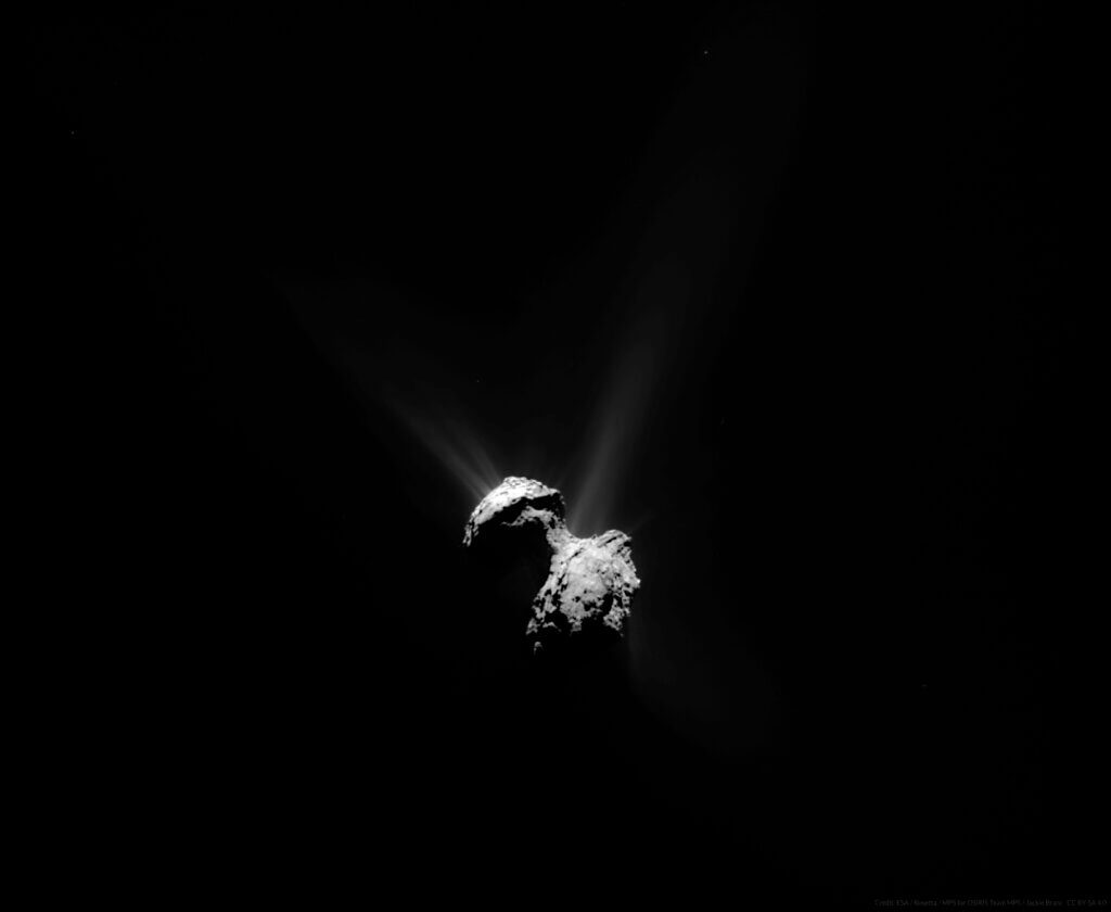
Product Identifier W20150711T210504975ID50F18.IMG
Dataset Identifier RO-C-OSIWAC-5-ESC3-67P-M18-GEO-V1.0
Start Time 2015-07-11T21:06:21.960
Stop Time 2015-07-11T21:06:22.279
Sub Instrument WAC
Western Most Longitude -180
Eastern Most Longitude 180
Minimun Latitude -78.704225
Maximun Latitude 90
Solar Distance 195159175.1855695
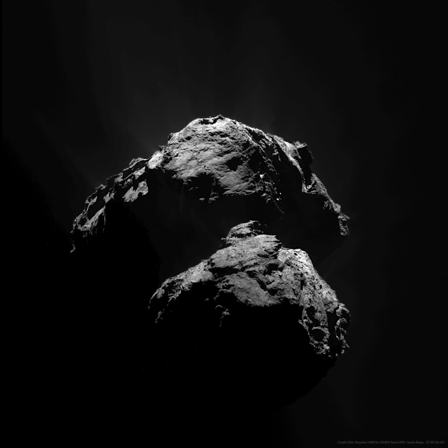
Product Identifier N20150711T160334239ID50F23.IMG
Dataset Identifier RO-C-OSINAC-5-ESC3-67P-M18-GEO-V1.0
Start Time 2015-07-11T16:04:51.218
Stop Time 2015-07-11T16:04:51.362
Sub Instrument NAC
Western Most Longitude -180
Eastern Most Longitude 180
Minimun Latitude -77.132831
Maximun Latitude 90
Solar Distance 195274469.53636315
Target Center Distance 160.23416632978117
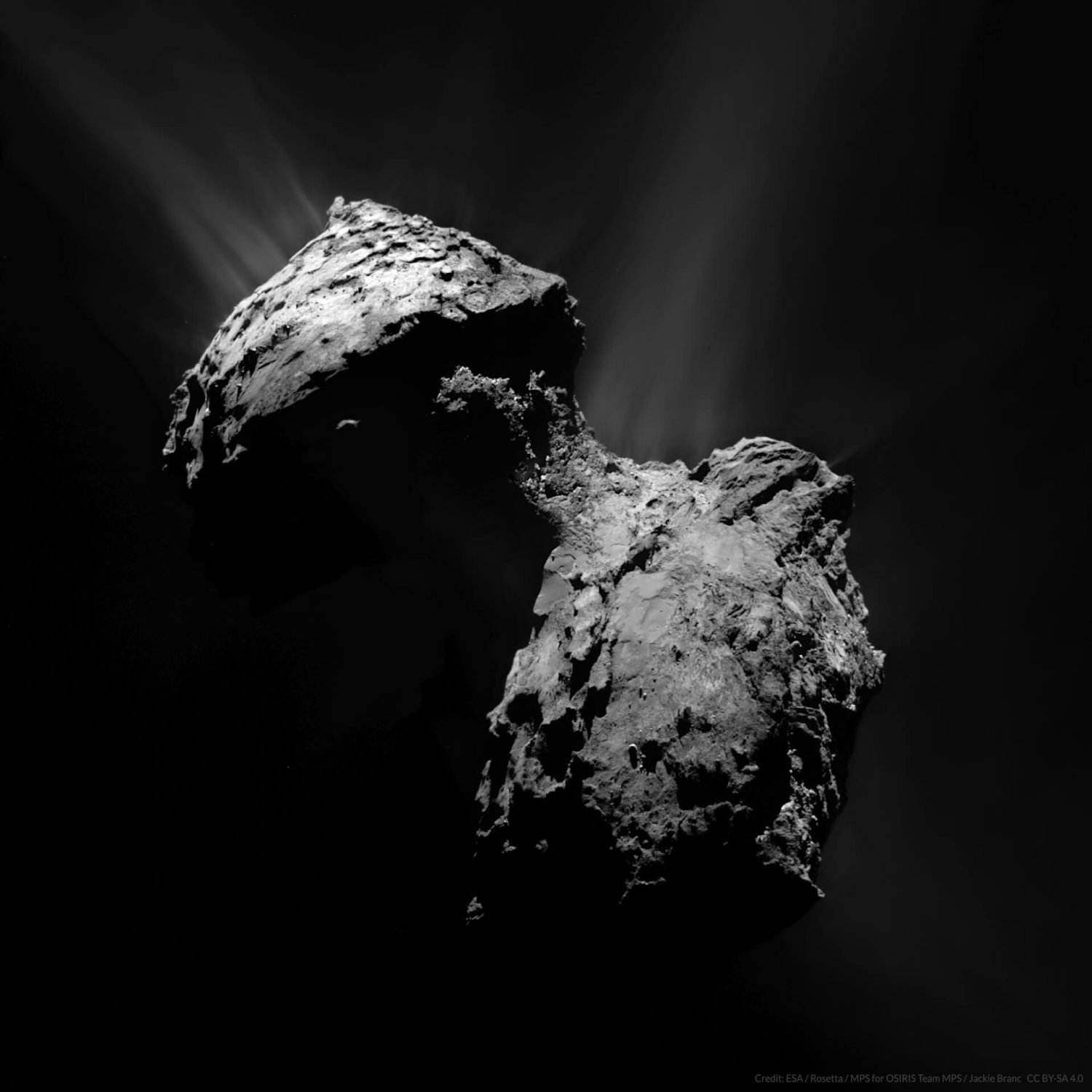
Product Identifier N20150711T204508372ID50F23.IMG
Dataset Identifier RO-C-OSINAC-5-ESC3-67P-M18-GEO-V1.0
Start Time 2015-07-11T20:46:25.356
Stop Time 2015-07-11T20:46:25.500
Sub Instrument NAC
Western Most Longitude -180
Eastern Most Longitude 180
Minimun Latitude -79.600178
Maximun Latitude 90
Solar Distance 195166781.96159375
Target Center Distance 158.7064084765269
Product Identifier N20150711T204508372ID50F23.IMG
Dataset Identifier RO-C-OSINAC-5-ESC3-67P-M18-GEO-V1.0
Start Time 2015-07-11T20:46:25.356
Stop Time 2015-07-11T20:46:25.500
Target 67P/C-G
Sub Instrument NAC
Western Most Longitude -180
Eastern Most Longitude 180
Minimun Latitude -79.600178
Maximun Latitude 90
Solar Distance 195166781.96159375
Target Center Distance 158.7064084765269
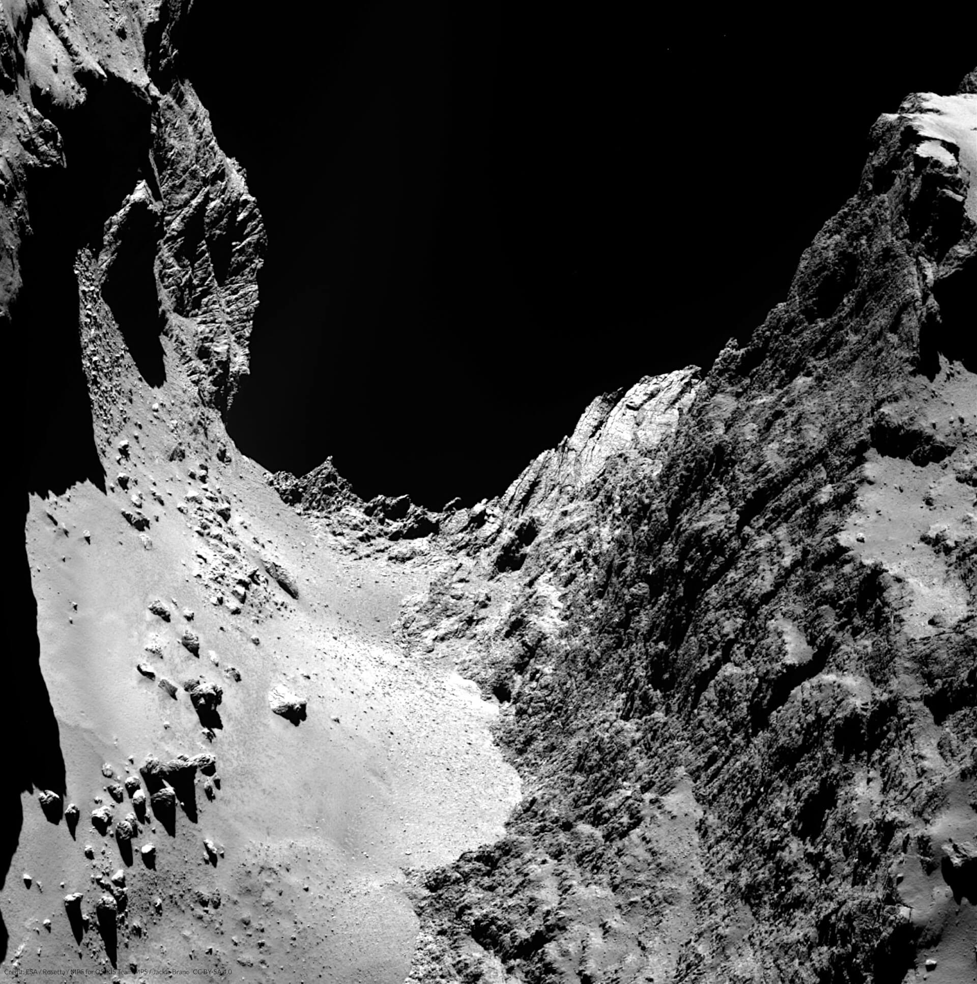
Product Identifier N20140922T210936336ID50F22.IMG
Dataset Identifier RO-C-OSINAC-5-PRL-67P-M07-GEO-V1.0
Start Time 2014-09-22T21:10:46.043
Stop Time 2014-09-22T21:10:46.512
Sub Instrument NAC
Western Most Longitude -180
Eastern Most Longitude 180
Minimun Latitude 17.500277
Maximun Latitude 90
Solar Distance 496207966.04219157
Target Center Distance 28.485776103177056
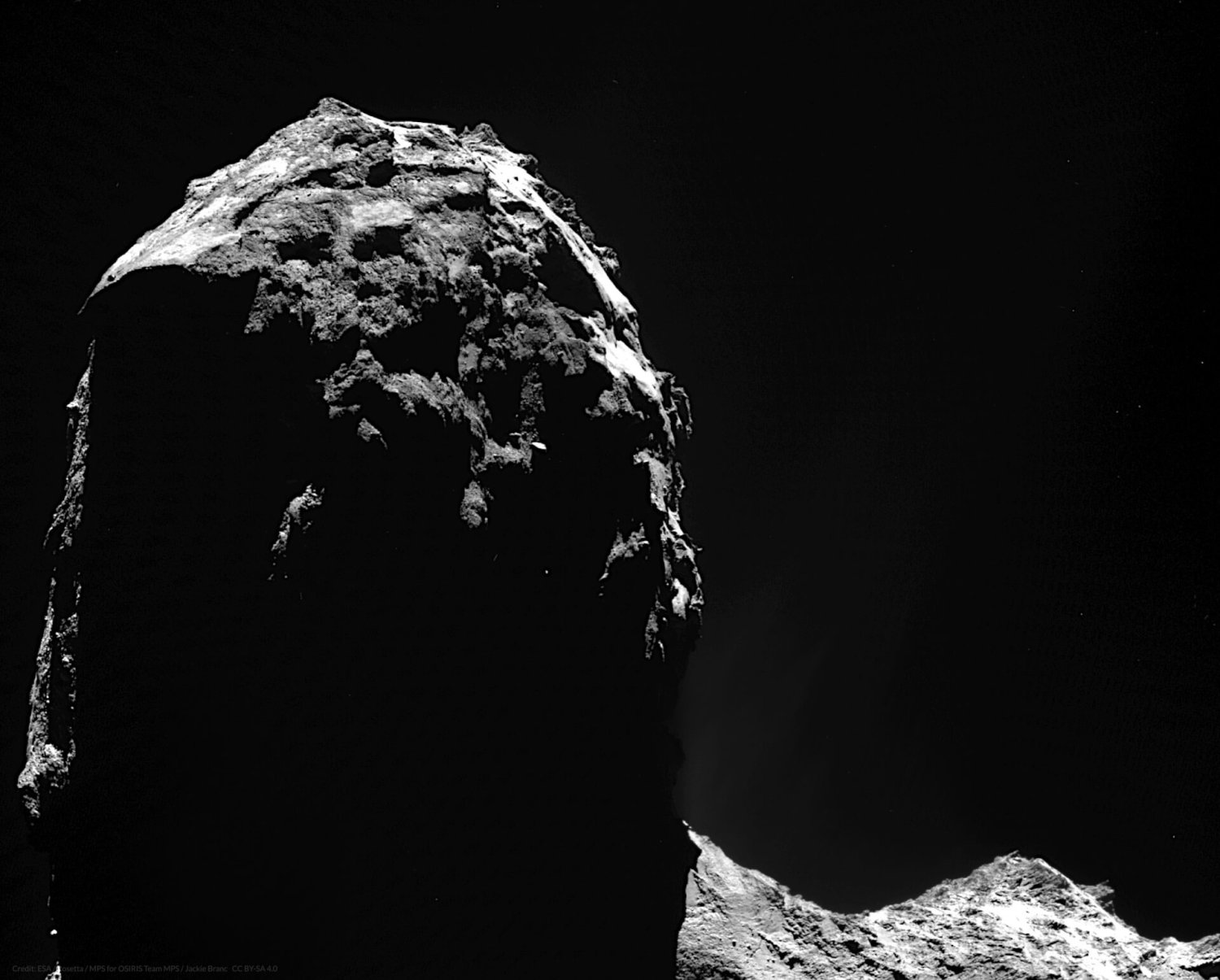
Product Identifier W20140930T122615752ID4FF17.IMG
Dataset Identifier RO-C-OSIWAC-4-PRL-67P-M08-INF-REFL-V1.0
Start Time 2014-09-30T12:27:25.678
Stop Time 2014-09-30T12:27:28.577
Sub Instrument WAC
Western Most Longitude -180
Eastern Most Longitude 180
Minimun Latitude -62.590007
Maximun Latitude 90
Solar Distance 489110837.06888795
Target Center Distance 18.13977240480626
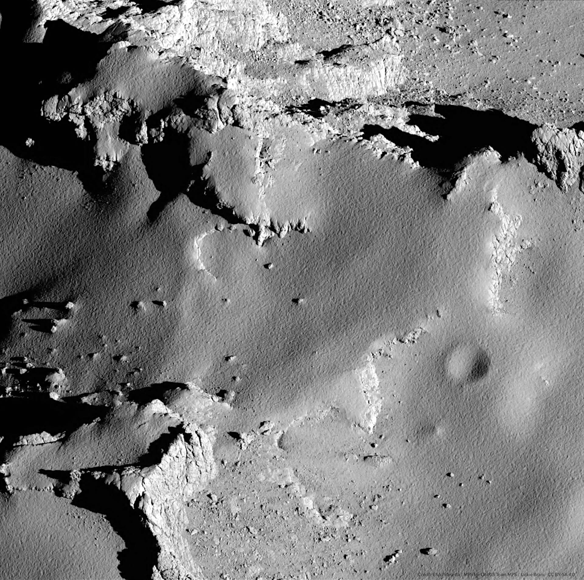
Product Identifier N20160930T040247742ID4DF22.IMG
Dataset Identifier RO-C-OSINAC-4-EXT3-67P-M35-STR-REFL-V1.0
Start Time 2016-09-30T04:04:17.280
Stop Time 2016-09-30T04:04:17.360
Sub Instrument NAC
Western Most Longitude 107.110251
Eastern Most Longitude 170.429022
Minimun Latitude 45.387237
Maximun Latitude 69.648437
Solar Distance 573255866.8331378
Target Center Distance 13.38599299114757
Credit: ESA / Rosetta / MPS for OSIRIS Team MPS / Jackie Branc CC BY-SA 4.0